|
|
Greetings from HAQAST
Dear HAQAST Community,
|
|
|
|
We are looking forward to seeing many of you at our upcoming meeting!
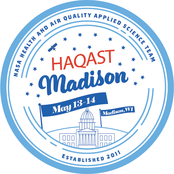
HAQAST Madison - May 13 & 14, 2026
Our next meeting is planned for May 13 and 14th, 2026 in Madison, Wisconsin, and online. Registration is free and you can use this link to register. We encourage in-person attendees to register by April 21st.
This year, we have a unique crossover event with leading journalists from across the country. Hosted by the Outrider Foundation, these leading science communicators will join our group and share their expertise. We have incorporated journalism expertise into HAQAST, and HAQAST expertise into the Outrider Science Media Forum.
|
|
|
|
|
|
HAQAST News
Tiger Teams
Many thanks to the volunteer reviewers from air quality and health organizations who generously reviewed the submitted Tiger Team proposals this year. Preliminary selections have been made, and final work plans and budgets are now in preparation. We expect these teams to start this summer. Announcements of funded teams will be coming soon!
Publications
You can find all of the latest HAQAST publications here! Some recent highlights are included below: Listen!
GeoHealth Frontlines is a new podcast from the AGU GeoHealth community, spotlighting the people and ideas at the intersection of geoscience and public health. The first episode features former and current HAQAST members Daniel Tong, discussing the health impacts of dust, and the second episode features Tracey Holloway, discussing how satellite observations inform research and decision-making for airu pollution and health. Listen now on Spotify or Apple Podcasts.
|
|
|
Upcoming Meetings and Events of Interest
- April 26 - 28: Health Effects Institute Annual Conference. Learn more here and register here.
- April 14, 8:00 - 10:30 am EDT - GEO Health Community of Practice Asia-Oceania Special edition. This teleconference will offer 4-minute flash talks on ongoing research applications that integrate Earth observation data into public health applications in the Asia-Oceania region. More information here.
- April 22 - 23: New Mexico Extreme Heat, Health, and Resiliency Summit. Leading experts on extreme heat will present critical information for health professionals over two half-day webinars. Register here.
- April 23 - NOAA/CPO Heat Research Webinar Series, Extreme Heat and Interconnected Hazards: New Research on Compounding and Cascading Impacts. Learn more and register here.
- May 3 - 8: European Geophysical Union (EGU) Spring 2026 Meeting. Vienna, Austria.
- May 6: ECHO Symposium: Translating Science to Action. This conference will examine how chemical exposures influence child health and development, with a focus on two key areas: plastics and air quality. In-person in Bethesda, MD, and online. Learn more and register here.
- May 8th, at 1:00 pm EDT: - Dust Alliance of North America (DANA) monthly webinar series, on "Evaluating the frequency, size, and duration of dust plumes in the Southwest and South Central United States using satellite and surface data", with Jennifer McGinnis. More on DANA webinars and recordings of past webinars can be found here.
- May 12 - 13 - NASA Satellite Needs Working Group Harmonized Landsat and Sentinel-2 2026 Workshop. Learn more and register here.
- May 13 - 14: HAQAST Madison. Join us in Madison, Wisconsin to learn about health and air quality, and satellite data! Learn more and register here.
- 15 May, 11:00 - 12:00 am EDT: One Earth, Shared Mission: Connecting GeoHealth and Planetary Health Communities. This joint webinar between the GeoHealth Section and the Planetary Health Alliance explores shared priorities, complementary strengths, and opportunities for collaboration. Register here.
- May 26 - June 2: NASA ARSET - Introduction to Thermal Remote Sensing and Applications in Urban Heat Island Mapping. Learn more and register here.
- September 7 - 11: iCACGP-IGAC Joint Conference: Atmospheric Chemistry within the Earth System: Understanding changes and impacts (Early career short course 4 - 6 September). Greece. Abstracts due February 27th.
- December 7 - 11, 2026: American Geophysical Union. Session proposals due April 22. More info.
- January 10 - 14, 2027: American Meteorological Society. Session proposals due April 30. More info.
- Ongoing, self-paced - ARSET Fundamentals of Remote Sensing (link here).
- In case you missed it, check out recent archived past events: ARSET Advanced NASA Earth Observations and Tools for Active Fire, Smoke, and Post-Fire Monitoring (archived here), ARSET Geostationary Remote Sensing of Trace Gases for Air Quality Applications in North America (archived here), the NASA PACE Applications Workshop: Putting PACE Data to Work Across the Earth System (archived here), and the GEO Health Virtual Capacity Building Workshop: EO for Air Quality (archived here).
|
|
|
Data and Tools
HAQAST Smoke Console
The HAQAST Smoke Console is a tool developed by NASA’s Health and Air Quality Applied Sciences Team (HAQAST) and the University of Wisconsin-Madison to streamline the analysis of satellite data for air quality management. Built on Google Earth Engine (GEE), the console integrates 21 layers of satellite measurements, meteorological data, and air quality reanalysis products to assist in creating Exceptional Event Demonstrations (EEDs) for ozone and PM2.5 air quality standard exceedances caused by wildland and prescribed fires. The console provides a user-friendly interface for visualizing and analyzing data, including TROPOMI CO, NO₂, HCHO, MODIS AOD, MERRA-2 black carbon, and dust flux vectors, and surface air quality observations. It enables air quality managers to construct narrative conceptual models, analyze meteorological conditions, track smoke transport, and provide evidence of smoke or dust reaching the surface. In addition, the console includes automated event flagging algorithms and allows users to export data for further analysis, making it a comprehensive resource for addressing exceptional events related to smoke. For more information, see the User Guide, Javascript code for GEE, and Web App.
New Python Library for NASA Earthdata
earthaccess is a Python library to search for and download or stream NASA Earth science data with just a few lines of code. earthaccess is a highly active, open-source, and community-driven library developed by NASA DAACs, private industry, and the broader NASA data user community. Learn more here.
TEMPO Version 04 and Near Real-Time Version 02 Level 1, 2, and 3 Data
TEMPO Version 04 (V04) and Near Real-Time Version 02 (V02) Level 1, 2, and 3 data are now available from the NASA Langley Atmospheric Science Data Center (ASDC) via NASA Earthdata Search. This data release includes new L2 and L3 ozone profile beta products, as well as TEMPO NRT L1B radiance and L2 /L3 clouds, nitrogen dioxide, and formaldehyde data products. Please note that TEMPO HCHO NRT V02 data is available starting September 18, 2025, and TEMPO radiance twilight V04 data will be available later this year. More information here.
TEMPO data are now available on Google Earth Engine (currently nitrogen dioxide and formaldehyde). You can find start code here. You can also find other trainings and tutorials for working with TEMPO data on various platforms here.
PACE Version 3.1 Ocean Color Instrument (OCI) reprocessing
In late August 2025 the PACE Science Data Segment initiated the version 3.1 reprocessing of all OCI products. This reprocessing is now complete, and full-mission PACE OCI V3.1 products can now be acquired from NASA’s EarthDataSearch. Notes on changes are available here. The PACE has added or will continue to add new produce suites with the update, including:
The next release is likely to be NO 2 and O 3 retrievals. More information about the PACE NO2 product can be found here.
Sub-Orbital Order Tool (SOOT)
The Sub-Orbital Order Tool, or SOOT, is a tool developed by the Atmospheric Science Data Center (ASDC) for handling data acquired from suborbital field campaigns that are archived at the ASDC. SOOT supports data discovery and accessibility for users interested in airborne and field campaign data and promotes suborbital research and analysis. SOOT offers a browse mode where you can browse freely between campaigns, and a search mode where you can search for data products via campaign, date, platform, and/or variable category. SOOT also provides a merge service to align data files to a common time base based on platform, collection date, and campaign. You can find the ASDC SOOT Interface here.
Ozonerates: Photochemically produced ozone (PO3) datasets, Python package, interactive map
Using bias-corrected HCHO and NO 2 retrievals along with other geophysical variables, this product generates PO₃ from OMI and TROPOMI data. The website also contains a Python package to predict PO₃, and an online interactive map to visualize the datasets.
MAIA Surface Monitor Data Product
The NASA Jet Propulsion Laboratory (JPL) Multi-Angle Imager for Aerosols (MAIA) project and NASA Langley's Atmospheric Science Data Center (ASDC) is excited to announce the release of the MAIA Surface Monitor Data Product. These products include ground-based measurements of total PM 2.5, total PM 10, and chemically speciated PM 2.5 at various locations within MAIA’s globally distributed set of Primary Target Areas (PTAs). Applications of these data include air quality, climate, and epidemiological research. Details about the sources of surface PM monitors used in the MAIA project can be found here. Learn more about the MAIA surface monitoring network here and access the PM and PM2.5 datasets.
Archived Datasets
If you are looking for data from retired federal websites, check out the Public Environmental Data Partners archive. The website includes the option to nominate data for preservation.
|
|
|
Funding Opportunities
NASEM and NOAA: The National Academies of Sciences, Engineering, and Medicine’s Gulf Research Program (GRP), in partnership with the National Oceanic and Atmospheric Administration (NOAA)’s Office of Education, is awarding up to $6 million to enhance the resilience of coastal communities across the U.S. Gulf Coast states (Texas, Louisiana, Mississippi, Alabama, and Florida) through place-based education. Learn more here.
Some opportunities that may be of interest in the NASA Research Opportunities in Space and Earth Sciences 2025 ( ROSES-2025).
- Impactful and novel use of NASA earth observations and models for value-added applications, technology, and societal benefits (INNOVATE) – Up to $1M over three years for the development and demonstration for EO tools and applications to meet a specific operational need of a third-party end-user organization. Data acquired through the NASA Commercial Satellite Data Acquisition program (including GHGSat data) may be used. Proposals can be submitted any time until March 31, 2026.
- Rapid response and novel research in Earth science (RRNES) – An unfunded catch-all program element that is intended to identify either time-sensitive research in response to an immediate and unforeseen event in the Earth system, or an exceptionally novel or innovative idea in Earth science that is not currently supported by another program element. Again, this program element is not funded itself but would instead attempt to match proposals with potential funding from other programs.
|
|
|
Call for Manuscripts
- TEMPO Data Products, Science and Applications. This special collection (JGR: Atmospheres, Geophysical Research Letters, and Earth and Space Science) focuses on TEMPO data products, including their development, demonstration of societal benefits, usage through data assimilation or analysis to improve understanding Earth and atmospheric processes, and their synergy with other satellite data products. Submissions are due December 31, 2026. More here.
|
|
|
|
|
|
Internships and Jobs
If you are hiring, please feel free to share via email or LinkedIn – we’d love to help the community connect!
Job Boards
Here are a few of the jobs boards which often include opportunities relevant to the health, air quality and remote sensing communities.
|
|
|
Other Opportunities
New NASA Commercial Impact Hub for Energy Decision-Making - Just as HAQAST is expanding our focus to increase value to industry, so is NASA overall. The energy sector is already a priority of HAQAST in terms of emissions, and the NASA Commercial Impact Hub aims to broaden applications to generation, risk, demand forecasting, and other data needs. If your organization already uses satellite data for energy decision-making, or if you’d like to learn more, please reach out to Tracey Holloway (taholloway@wisc.edu).
New NASA PolSIR Mission: The Polarized Submillimeter Ice-Cloud Radiometer ( PolSIR) is a new NASA satellite mission with the goal of understanding the influence of ice clouds on our dynamic planet. PolSIR is led by Ralf Bennartz at Vanderbilt University and Dong Wu at NASA Goddard Space Flight Center.
As the PolSIR mission is under development the Applications Team is beginning to engage with the community of science and applications stakeholders to document potential applications that amplify the benefit for PolSIR for operations, applications, decision-making, and policy. With PolSIR observing the diurnal cycle of ice clouds in the tropics and sub-tropics current applications themes include:
- Climate Modeling and Monitoring
- Numerical Weather Prediction, Data Assimilation, Model Validation and Parameterization
- Severe Storms, Tropical Convection, Hurricanes
- Lightning, Sprites, Jets
- Aviation Planning and Policy
If you are interested in hearing PolSIR Applications Updates and to receive invitations to Quarterly Applications Telecons and Workshops, please fill out this form to be added to the email list.
If you are interested in becoming a PolSIR Early Adopter, skip the interest form - go straight to the PolSIR Early Adopter Program form to say how you want to use PoLSIR data for an Early Adopter Project.
|
|
|
|
|
|
Connect with HAQAST
We are always appreciative of your interest and involvement in the team. If you have colleagues who might also be interested, please invite them to sign up on our mailing list. You can also follow and connect with HAQAST on LinkedIn, or reach out personally with Tracey (taholloway@wisc.edu) and Jenny (bratburd@wisc.edu).
|
|
|
|
|