|
|
Greetings from HAQAST
Dear HAQAST Community,
|
|
|
|
We have a lot of news to share, including recordings of great kickoff meeting, dates for the next upcoming HAQAST meeting, planning for Tiger Teams, funding and fellowship opportunities from the community!
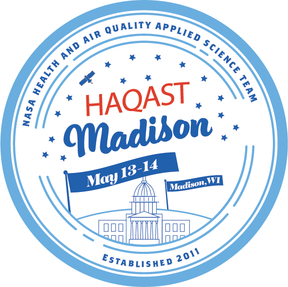
Save the date - HAQAST Madison - May 13 & 14, 2026
Our next meeting is planned for May 13 and 14th, 2026 in Madison, Wisconsin, and online. Please save the date, and join us! Registration is free. You can register and indicate your interest in speaking on the registration form. Learn more here: https://haqast.org/haqast-madison/
|
|
|
|
|
|
HAQAST News
HAQAST St. Louis recordings
It was great seeing many of you at the HAQAST St. Louis meeting on November 6-7!
Recordings, slides and posters are now available on the website: https://haqast.org/haqast-st-louis/ You can also find recordings on the HAQAST YouTube, with segments in the description to help you quickly find a single speaker in a session.
Tiger Team Reviewers
HAQAST is planning for a new round of Tiger Teams! A Tiger Team is a short-term, high-impact collaborative effort between HAQAST members and public stakeholders to identify and solve an immediate problem using NASA data and products. Each Tiger Team draws on the expertise of multiple HAQAST PIs to find the best, multifaceted solutions to pressing health and air quality issues.
Because Tiger Teams are intended to address priority needs for the public and private sectors, we rely on volunteer reviewers from these organizations — air quality managers, consultants, health professionals, and other members of the HAQAST community. Please consider contributing your time and expertise. Each reviewer will be asked to review ~20 pages of material and fill out streamlined reviewer input forms, with the process targeted for February 2026.. If you are willing to serve this important role, please consider signing up on this form.
Publications
You can find all of the latest HAQAST publications here! Some recent highlights are included below:
|
|
|
Upcoming Meetings and Events of Interest
- Ongoing, self-paced - ARSET Fundamentals of Remote Sensing.
- December 15 - 19: American Geophysical Union (AGU25) - Many HAQAST members, co-Is and students will be participating in many sessions. To highlight one session - GH12A - Actionable Uses of Satellite Observations for Health and Air Quality on Monday morning will feature several HAQAST PIs, and the corresponding afternoon poster session will feature several HAQAST projects.
- January 13 and 14, 2026: Virtual Capacity Building Workshop: EO for Air Quality: Focus on Africa. As part of the GEO Health Air Quality Work Group activities, this online workshop will introduce attendees to available Earth observation data supporting air quality research and management, with a focus on capabilities and applications in Africa. This workshop aims to provide tools for accessing and analyzing these data, and will also point to resources for future capacity building. This workshop is open to all levels of expertise within our global community! Register here.
- January 14 & 21: NASA ARSET- Advanced NASA Earth Observations and Tools for Active Fire, Smoke, and Post-Fire Monitoring. This two-part training led by NASA's Applied Remote Sensing Training (ARSET) program will introduce participants to several capabilities within FIRMS that were not included in the previous ARSET training, Introduction to NASA Earth Observations and Tools for Wildfire Monitoring and Management. Participants will learn how to use the FIRMS aerosol index indices, burned area products, post-fire indices and imagery, static thermal anomaly information, and how to use Jupyter Notebooks to ingest and visualize active fire detection data. Learn more here.
- January 20 - 22: NASA ARSET - Geostationary Remote Sensing of Trace Gases for Air Quality Applications in North America. This training will provide an overview of TEMPO capabilities and available trace gas data products, and illustrate how TEMPO data can be visualized. Online. Learn more and register here.
- January 20 - 23: ESIP meeting. The theme for 2026, "Bridging Divides: Data, Technology, Community," calls on the Earth Science Data community to continue to build more open data ecosystems, harmonize tools and resources, and strengthen the human connections that are the bedrock of great science. Submission deadline: November 13. More information here.
- January 25 - 29: American Meteorological Society (AMS) Annual Meeting 2026.
- February 13 at 1:00 pm: Dust Alliance of North America (DANA) monthly webinar series kicks off the new year with “Understanding the semi-direct effects of dust above low-level clouds over the North Atlantic Ocean.” Online. More on DANA webinars and recordings of past webinars can be found here.
- February 18: NOAA's Satellite Applications Symposium Series: Fire. Get updates about new data available, satellite instrument development progress, various applications of satellite data for wildfire detection and monitoring, and provide feedback on your changing needs and challenges. Learn more and register here.
- May 3 - 8: European Geophysical Union (EGU) Spring 2026 Meeting. Vienna, Austria. Abstracts due January 15th.
- May 13 - 14: HAQAST Madison. Join us in Madison, Wisconsin to learn about health and air quality, and satellite data! Learn more and register here.
- September 7 - 11: iCACGP-IGAC Joint Conference: Atmospheric Chemistry within the Earth System: Understanding changes and impacts (Early career short course 4 - 6 September). Greece. Abstracts due February 27th.
|
|
|
Internships and Jobs
If you are hiring, please feel free to share via email or LinkedIn – we’d love to help the community connect!
Job Boards
Here are a few of the jobs boards which often include opportunities relevant to the health, air quality and remote sensing communities.
Fellowships
AMS Richard Grotjahn Research Fellowship in Extremes. The Richard Grotjahn Research Fellowship in Extremes (RGRFE) provides a research fellowship to a graduate student pursuing a degree in meteorology, atmospheric, or related sciences. Specifically, the 8- to 10-week fellowship will support a graduate student in conducting research in the general area of extremes-related research under the guidance of a mentor. Applications due February 1, 2026.
HEI 2026 Summer Fellowship
The HEI Summer Fellowship Program aims to encourage rising juniors and seniors to explore research opportunities in the environmental health sciences. The program supports highly qualified undergraduate students who would not otherwise have a similar opportunity. Deadline Jan 5, 2026. Learn more here.
|
|
|
Funding Opportunities
IGAC ECR Small Grant Development Grant
Supporting emerging researchers in atmospheric chemistry and related fields with flexible, targeted funding for travel, training, collaborations, and independent projects. Grants range from $500 - $2,000 USD. Expressions of Interest due 5 January 2026. For more information, see here.
HEI RFA 25-2: Walter A. Rosenblith New Investigator Award
This new investigator award supports creative early career investigators, at the Assistant Professor or equivalent level, with outstanding promise who are interested in the health effects of air pollution. Preliminary applications due date is January 23rd, 2026 (full applications due June 5th). Learn more here.
NASA Lifelines Ready for Impact (RFI) Crisis Readiness Accelerator
Are you working on a project that uses satellite data or digital communications for disaster response in Colombia or Latin America? Looking for support scaling? The Ready for Impact (RFI) Crisis Readiness Accelerator is a 4-6 month incubator designed to help you grow your impact. Grants of up to $20,000 USD are available. Second round of applications due February 1st. Learn more here.
Some opportunities that may be of interest in the NASA Research Opportunities in Space and Earth Sciences 2025 ( ROSES-2025).
- Impactful and novel use of NASA earth observations and models for value-added applications, technology, and societal benefits (INNOVATE) – Up to $1M over three years for the development and demonstration for EO tools and applications to meet a specific operational need of a third-party end-user organization. Data acquired through the NASA Commercial Satellite Data Acquisition program (including GHGSat data) may be used. Proposals can be submitted any time until March 31, 2026.
- Rapid response and novel research in Earth science (RRNES) – An unfunded catch-all program element that is intended to identify either time-sensitive research in response to an immediate and unforeseen event in the Earth system, or an exceptionally novel or innovative idea in Earth science that is not currently supported by another program element. Again, this program element is not funded itself but would instead attempt to match proposals with potential funding from other programs.
|
|
|
Call for Manuscripts
- TEMPO Data Products, Science and Applications. This special collection (JGR: Atmospheres, Geophysical Research Letters, and Earth and Space Science) focuses on TEMPO data products, including their development, demonstration of societal benefits, usage through data assimilation or analysis to improve understanding Earth and atmospheric processes, and their synergy with other satellite data products. Submissions are due December 31, 2025. More here.
|
|
|
Data and Tools
New Python Library for NASA Earthdata
earthaccess is a Python library to search for and download or stream NASA Earth science data with just a few lines of code. earthaccess is a highly active, open-source, and community-driven library developed by NASA DAACs, private industry, and the broader NASA data user community. Learn more here.
TEMPO Version 04 and Near Real-Time Version 02 Level 1, 2, and 3 Data
TEMPO Version 04 (V04) and Near Real-Time Version 02 (V02) Level 1, 2, and 3 data are now available from the NASA Langley Atmospheric Science Data Center (ASDC) via NASA Earthdata Search. This data release includes new L2 and L3 ozone profile beta products, as well as TEMPO NRT L1B radiance and L2 /L3 clouds, nitrogen dioxide, and formaldehyde data products. Please note that TEMPO HCHO NRT V02 data is available starting September 18, 2025, and TEMPO radiance twilight V04 data will be available later this year. More information here.
TEMPO data are now available on Google Earth Engine (currently nitrogen dioxide and formaldehyde). You can find start code here. You can also find other trainings and tutorials for working with TEMPO data on various platforms here.
PACE Version 3.1 Ocean Color Instrument (OCI) reprocessing
In late August 2025 the PACE Science Data Segment initiated the version 3.1 reprocessing of all OCI products. This reprocessing is now complete, and full-mission PACE OCI V3.1 products can now be acquired from NASA’s EarthDataSearch. Notes on changes are available here. The PACE has added or will continue to add new produce suites with the update, including:
The next release is likely to be NO 2 and O 3 retrievals. More information about the PACE NO2 product can be found here.
Sub-Orbital Order Tool (SOOT)
The Sub-Orbital Order Tool, or SOOT, is a tool developed by the Atmospheric Science Data Center (ASDC) for handling data acquired from suborbital field campaigns that are archived at the ASDC. SOOT supports data discovery and accessibility for users interested in airborne and field campaign data and promotes suborbital research and analysis. SOOT offers a browse mode where you can browse freely between campaigns, and a search mode where you can search for data products via campaign, date, platform, and/or variable category. SOOT also provides a merge service to align data files to a common time base based on platform, collection date, and campaign. You can find the ASDC SOOT Interface here.
Ozonerates: Photochemically produced ozone (PO3) datasets, Python package, interactive map
Using bias-corrected HCHO and NO 2 retrievals along with other geophysical variables, this product generates PO₃ from OMI and TROPOMI data. The website also contains a Python package to predict PO₃, and an online interactive map to visualize the datasets.
MAIA Surface Monitor Data Product
The NASA Jet Propulsion Laboratory (JPL) Multi-Angle Imager for Aerosols (MAIA) project and NASA Langley's Atmospheric Science Data Center (ASDC) is excited to announce the release of the MAIA Surface Monitor Data Product. These products include ground-based measurements of total PM 2.5, total PM 10, and chemically speciated PM 2.5 at various locations within MAIA’s globally distributed set of Primary Target Areas (PTAs). Applications of these data include air quality, climate, and epidemiological research. Details about the sources of surface PM monitors used in the MAIA project can be found here. Learn more about the MAIA surface monitoring network here and access the PM and PM2.5 datasets.
Archived Datasets
If you are looking for data from retired federal websites, check out the Public Environmental Data Partners archive. The website includes the option to nominate data for preservation.
|
|
|
|
|
|
Other Opportunities
New NASA Commercial Impact Hub for Energy Decision-Making - Just as HAQAST is expanding our focus to increase value to industry, so is NASA overall. The energy sector is already a priority of HAQAST in terms of emissions, and the NASA Commercial Impact Hub aims to broaden applications to generation, risk, demand forecasting, and other data needs. If your organization already uses satellite data for energy decision-making, or if you’d like to learn more, please reach out to Tracey Holloway (taholloway@wisc.edu).
New NASA PolSIR Mission: The Polarized Submillimeter Ice-Cloud Radiometer ( PolSIR) is a new NASA satellite mission with the goal of understanding the influence of ice clouds on our dynamic planet. PolSIR is led by Ralf Bennartz at Vanderbilt University and Dong Wu at NASA Goddard Space Flight Center.
As the PolSIR mission is under development the Applications Team is beginning to engage with the community of science and applications stakeholders to document potential applications that amplify the benefit for PolSIR for operations, applications, decision-making, and policy. With PolSIR observing the diurnal cycle of ice clouds in the tropics and sub-tropics current applications themes include:
- Climate Modeling and Monitoring
- Numerical Weather Prediction, Data Assimilation, Model Validation and Parameterization
- Severe Storms, Tropical Convection, Hurricanes
- Lightning, Sprites, Jets
- Aviation Planning and Policy
If you are interested in hearing PolSIR Applications Updates and to receive invitations to Quarterly Applications Telecons and Workshops, please fill out this form to be added to the email list.
If you are interested in becoming a PolSIR Early Adopter, skip the interest form - go straight to the PolSIR Early Adopter Program form to say how you want to use PoLSIR data for an Early Adopter Project.
|
|
|
|
|
|
Connect with HAQAST
We are always appreciative of your interest and involvement in the team. If you have colleagues who might also be interested, please invite them to sign up on our mailing list. You can also follow and connect with HAQAST on LinkedIn, or reach out personally with Tracey (taholloway@wisc.edu) and Jenny (bratburd@wisc.edu).
|
|
|
|
|